Custom Search
|
|
 
|
||
|
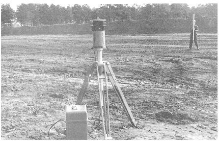
ELECTRONIC POSITIONING SYSTEMS Three classes of modern positioning systems are used to determine positions on the surface of the earth. Two of the classes are the initial positioning systems and the doppler positioning systems. The initial positioning systems require experience with navi-gational systems on board aircraft, and the doppler systems deal with signals received from satellites. Both systems are beyond the scope of our discussions; however, the doppler positioning systems will be discussed briefly at the EA1 level in part 2 of this TRAMAN. The third class of positioning systems is the electronic positioning systems. Electronic positioning systems consist of specially designed short-to-medium range EDMs that are attached to, or built into, a theodolite and can be used to determine distances and directions from a single setup of the instrument. Although many different electronic positioning systems are manufactured, each individual instrument is classed into one of three general groups as follows: 1. Combined theodolite and EDM. Instruments within this group consists of an optical-reading repeating or direction theodolite with an attached EDM transmitter that can be removed for independent use of the theodolite. 2. Computerized theodolite and EDM. The instruments in this group are similar to those within the combined theodolite and EDM group but have built-in electronic computers. 3. Electronic tachometers. The equipment in this integrated, digitized, electronic systems consist of a digitized theodolite, microprocessor, and EDM transmitter incorporated into one instrument. The instruments in this group also can be equipped with solid-state memory and magnetic tape or punched-paper- tape storage units for storage of data. The above systems can be applied to nearly any type of surveying that is discussed in this or the EA3 TRAMAN; however, for the normal day-to-day work that the EA surveyor performs, you will have little need for these types of instruments since most of the surveys you perform require only lower-order precision. When its use is justified, however, an electronic tachometer is available as augment equipment for the Naval Mobile Construction Battalions. The equipment consists of an electronic digitized theodolite, an EDM unit, a microprocessor, a keyboard and display register, and a data storage unit. By inputting certain controlling data,
Figure 12-6.Rotating laser level. such as temperature and atmospheric pressure that the built-in atmospheric correction system needs, and by proper manipulation of the instrument controls, the operator can obtain horizontal angles, vertical angles, slope distances, horizontal distances, relative elevation, and coordinates of an unknown point. The data obtained is displayed through a liquid crystal display and can be transmitted and stored in a separate data collector. Complete operating instructions are provided with the tacheometer. |
 
|
|
|
||